News Summary
Kansas City is under a heat advisory as temperatures soar to 96 degrees with a heat index nearing 110. Residents are urged to stay hydrated and indoors as storms may bring relief, but also flash flood warnings. A significant temperature drop is expected following the storms, leading to cooler weather by the weekend.
Kansas City is bracing for dangerously high temperatures and humidity, with a heat advisory in effect until 7 p.m. for parts of the region. On Tuesday, temperatures are projected to hit around 96 degrees, while the heat index is expected to feel close to 110 degrees. The National Weather Service warns that the combination of high temperatures and humidity could lead to heat-related illnesses.
Residents are strongly advised to stay hydrated, remain indoors in air-conditioned spaces when possible, avoid prolonged sun exposure, and check in on neighbors and friends during the extreme heat.
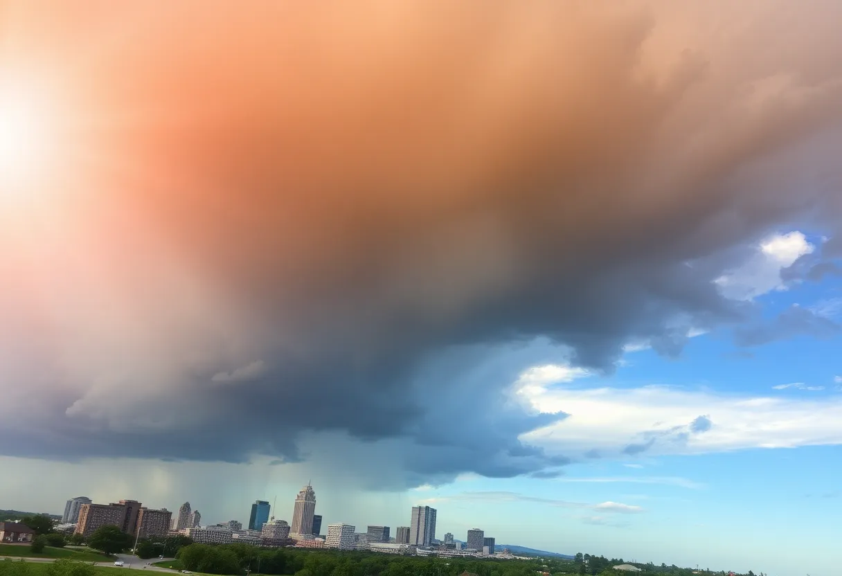
Relief from the oppressive heat is expected to arrive with incoming storms, which will begin to move into the area overnight Tuesday. Storms projected to move southeast from Nebraska will reach northwest Missouri by early Wednesday. The severe weather may bring strong to damaging winds, though there remains uncertainty regarding the exact areas that will be most affected.
A cold front is anticipated to accompany these storm systems, leading to periods of rain and thunderstorms through Thursday morning. Heavy rainfall is possible on Tuesday night and into Wednesday, prompting warnings for localized flash flooding. Most of the Kansas City area is under a slight risk for excessive rainfall from 7 a.m. Wednesday through 7 a.m. Thursday, as well as a marginal risk for severe wind gusts.
While some areas will continue to face heat advisories until 7 p.m. Wednesday, Kansas City is expected to see a high of around 91 degrees that day, with heat indices reaching near the 100-degree mark. Any lingering storms are forecasted to clear the metro area by noon on Thursday, marking a significant shift in weather conditions.
With the passage of the cold front, cooler and drier air will enter the region, leading to temperatures that are more characteristic of September. Forecasts predict highs in the metro will drop to around 77 degrees on Thursday, considerably lower than the typical 89 degrees for this time of year. Northern Missouri may see highs in the mid-70s, while the Ozarks could reach around 80 degrees.
The pleasant weather is expected to continue into the weekend, with highs around 76 degrees on both Friday and Saturday, and near 80 degrees on Sunday. There is, however, a slight chance of showers and thunderstorms returning on Monday.
Wednesday has been designated an Impact Day due to the scattered thunderstorms anticipated throughout the morning and afternoon. High temperatures on Wednesday may reach the upper 80s, with the heat index close to 100 degrees. Morning storms are expected between 6 a.m. and 9 a.m., with a second wave likely from 2 p.m. to 8 p.m. Some thunderstorms could be accompanied by strong wind bursts, with the National Weather Service issuing a Level 1 out of 5 risk for severe weather and a Level 2 out of 4 risk for flash flooding.
Interestingly, the extreme heat and subsequent cooling front may yield one of the coolest ends to July on record, with anticipated highs dropping to around 76 degrees. Likewise, forecasts indicate that the beginning of August could also be marked by the coolest temperatures seen in nearly 30 years.
As Kansas City prepares for these weather shifts, residents should take precautions to ensure their safety and comfort during the extreme heat, while also staying alert for any developments regarding the incoming storms.
Deeper Dive: News & Info About This Topic
HERE Resources
Major Heatwave Hits 185 Million Americans
Kansas City Weather Update: Heat Wave Recedes with Cooling Rain
Kansas City Cracks Down on Street Racing and Sideshow Activities
DirecTV Customers Experience Blackout of Major Channels
Ace Hardware Opens New Retail Support Center in Kansas City
Severe Flooding Affects East Kansas City Businesses
Extreme Heat Wave Sweeps Across the Northeast U.S.
Kansas City Celebrates New Ace Hardware Retail Support Center
Historic Flash Flooding Devastates Ruidoso, New Mexico
Water Main Break Causes Traffic Disruptions in Overland Park
Additional Resources
- KMBC: Kansas City Weather – High Heat, Humidity, Cooler Rain Later
- Kansas City Star: Weather News
- KMBC: Kansas City Weather Blog – Heat Advisory, Humidity
- Wikipedia: Weather
- Fox 4 KC: Joe’s Blog – It’s Not the Heat, It’s the Humidity
- Encyclopedia Britannica: Humidity
- KCTV5: First Warn Weather – One Last Day of Dangerous Heat
- Google Search: Kansas City Weather